Along the Oregon Trail
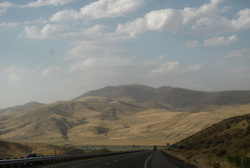
Approacing Blue Mountains and Snake River
Interstate 84 enters into Oregon at Ontario. The paved surface closely follows the general trail of the emigrants of the early 1840's through 1869. The wide and slow moving water in the valley near Ontario provided an easier crossing than the high and treacherous river canyons north and south. Of course, the wagons had to then follow the Snake River through the mountain range west of the valley.
R
Indian Head and Dead Indian Ridge. A gap in between a mountain range cut by the Snake River. Interstate 84 and the Oregon Trail ran through this gap following an old Indian trail. We would be spending the night just across the river from this ridge.
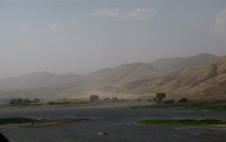
Farewell Bend on the Snake River
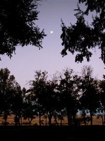
Full Moon and sunrise at Farewell Bend
We spent the night at Farewell Bend State Park on the riverside. Many Oregon Trail emigrants traveled through the Snake River country for over 300 miles. Hardship and danger were constant companions, and river crossings were especially challenging. But the rivers also sustained life providing water and fish. This section of the trail veered northwest away from the river which is where the name of the bend derived. The flat bottom and grass here often served as a camping area for both natives and emigrant.
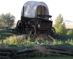
Replica of emigrant wagon
Wagon ruts not far from the park. A gravel road on the east side of the river (Idaho) follows the river.
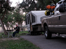
Our wagon
As we unpacked the borrowed pop-up camper, we discovered an issue which would plague us the rest of our entire trip: it was coming apart.
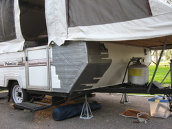
Red Green's Poop-up Camper
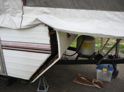
The left front wall had completely separated from the frame and siding. Sticking my finger in underneath revealed shards of rotted wood; there was no solid structure for screws to hold the siding on.
I drove the truck back to a small truck stop at the Interstate frontage and bought the largest roll of duck tape available. We then proceeded to push the front siding in place and tightly secure it with layers of tape. Red Green would be proud. From then on, I referred to it as the Poop-up camper.
We did all this in winds gusting 60 mph or more. At one point we heard a thunderous crash; a large limb broke off a towering tree next to the restroom and fell on the nearby dumpster. I looked up at the surrounding trees waving and creaking in the wind overhead and wondered if we were going to make it through the night intact. The entire camper shook and rattled all night. As the sun rose I woke to barely a breeze and sighed with relief.
Farewell Bend
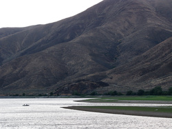
Indian Head Ridge and Snake River
We strolled down to the river and delighted in the views across to Indian Head Ridge. One lone fishing boat dotted the water and geese were everywhere. The water reflected light before the sun rose over the ridge.
This campground is a wonderful place to stay. Quiet and peaceful, I can imagine how it might have been 200 or more years ago. But neither the emigrants on the Oregon Trail nor I at the time ever suspected that this land, as well as all of the Blue Mountains and it's sub-ranges, were once volcanic islands far out in an ocean that would become the Pacific. And near here was at one time, more than 160 million years ago, the coastline of the North American continent.
I look forward to returning here some time in the following years for an an extended stay. Along with the little dirt-worth bikes, for there are many gravel roads along the Snake river and the base of these mountains that I want to explore.
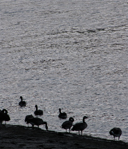
Geese along the Snake River shore
