Blue Mountains
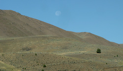
Full Moon over Blue Mnts.
The Oregon Trail and modern-day Interstate 84 wind and meander through the Blue Mountains in NE Oregon. Here are the oldest mountains in the state. The sub-ranges of the Blue Mountains were once an arc of volcanic islands thousands of miles south and further west in a giant ocean called Panthalassa.
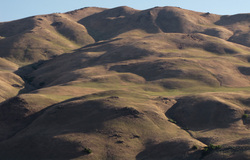
Velvety slopes of NE Blue Mnts.
The volcanic islands violently merged with the coast of the North American continent through plate tectonics, between 119 and 95 millions years ago. These mountains, whose summits reach 5-9 thousand feet, contain the oldest rock and oldest fossils in Oregon. They also border one of the most winding rivers and deepest canyon in the nation: Snake River and Hell's Canyon.
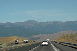
I-84 heading up into the mountains
The Blue Mountains were the last mountain range that emigrants on the Oregon Trail had to cross before reaching the Columbia River gorge and the valleys east of the Cascades. It was also a very formidable crossing.
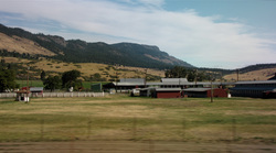
Ranch in La Grande valley
Today the beauty and ruggedness of these mountains invite and entice people to explore and settle in the rich valleys. Agriculture is dominant in the valleys, while the mountain slopes, rivers and canyons provide ample recreation opportunities. We would visit these mountains later both on the bikes and again driving through.
Yet a most memorable sight was only several miles ahead of us on the Interstate.
Yet a most memorable sight was only several miles ahead of us on the Interstate.
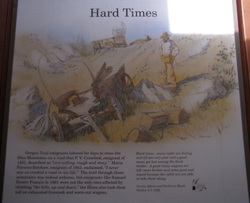
Mural at Deadman Pass Rest Area
Deadman Pass
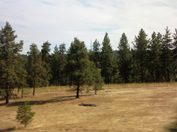
Mixed grasslands and forested slopes on ascent
The truck began climbing up through pines, spruce and fir forests. Soon the highway was a band of pavement surrounded and dwarfed by tall evergreen trees. We pulled into a rest area well off the highway and nestled in the forest for break.
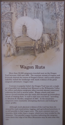
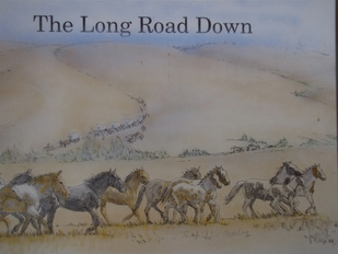
Mural at rest area. Trai ruts nearby.
In various spots around the area were interpretive murals about the Oregon Trail's crossing through the Blue Mountains. Two hiking trails led to long sections of the trail with visible ruts in the ground.
"Oregon Trail emigrants typically reached Deadman Pass, then known as Crawford Hill, after three days travel over what Edward Evans Parrish, emigrant of 1844, called "the worst road yet." the descent from this site to the banks of the Umatilla River, noted George N. Taylor in 1853, was "steep but not sideling." Once down the hill, emigrants camped along the Umatilla River, and many like Cecelia Adams and Parthenia Blank, emigrants of 1852, found the valley "literally dotted with ponies." "
The name, "Deadman’s Pass", was the result of an accident during the Bannock War when a teamster driving a wagon through the pass was killed by renegade Indians from the nearby Indian agency. Several other violent deaths in the pass reinforced the name over the years. The trail, and the modern highway, then descended down the hill into the valley. It was this descent that was arduous then for the emigrants and remains the most hazardous section in Oregon on Interstate 84.
The name, "Deadman’s Pass", was the result of an accident during the Bannock War when a teamster driving a wagon through the pass was killed by renegade Indians from the nearby Indian agency. Several other violent deaths in the pass reinforced the name over the years. The trail, and the modern highway, then descended down the hill into the valley. It was this descent that was arduous then for the emigrants and remains the most hazardous section in Oregon on Interstate 84.